GEOGRAPHY
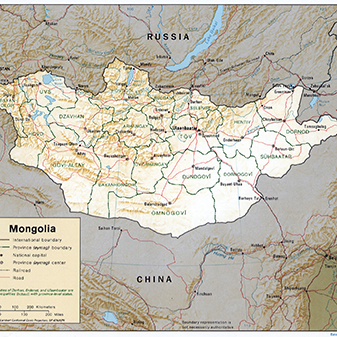
Mongolia is a huge, landlocked country about 3 times the size of France, squashed between China and Russia. At 1,564,116 km2 Mongolia is the world’s 19th-largest country. It was immeasurably bigger during the period of Mongol conquest under Genghis Khan and Kublai Khan. Until the 20th century Mongolia was twice its present size and included a large chunk of Siberia and Inner Mongolia (now controlled by China).
Mongolia has a 3,000km (1,864ml) border with the Russian Federation in the north and a 4,670km (2,901ml) border with China in the south. From north to south it can be divided into four areas: mountain-forest steppe, mountain steppe and, in the extreme south, semi-desert and desert (the latter being about 3% of the entire territory).
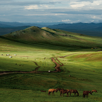
Mongolia is one of the highest countries in the world, with an average elevation of 1,580m (5,180ft). Its highest mountains are in the far west. The Mongol Altai Nuruu are permanently snowcapped, and their highest peak, Tavanbogd Mountain (4,370m/14,350ft), has a magnificent glacier that towers over Mongolia, Russia and China. Between the peaks are stark deserts where rain almost never falls. The lowest point, Khuch Lake, in the east, lies at 560m (1,820ft). The extensive grasslands of the steppes covering the center and eastern part of the land with a 360° view are the heart of Mongolia. The south is the domain of the Gobi Desert (extending down to China) with large sand dune areas and canyons in Eastern Gobi, the “dinosaur graveyard”. Much of the rest of Mongolia is grassland, home to Mongolia’s famed takhi horses, which Genghis Khan used so successfully in his wars of conquest.
Mongolia is dotted with about 4,000 lakes (one of which is Lake Huvsgul, which contains 2% of the world’s fresh water) and rivers where fishing is abundant.


